


-
Regarding district related
District Introduction
History and tradition
Geographical and Economic
District Branding
Other
শিক্ষা ও কল্যাণ
-
Administration
Deputy Commissioner
Deputy Commissioner\'s Office
ADC
Resolutions of Meeting
Important information
Branch related
Innovation Activities
Information and complaints
-
Local Government
district Council
Municipality
Upazila Council
-
Govt. Offices
Law and order and safety
Education and Cultural Affairs
-
District Education Office
-
District Primary Education Office
-
Bureau of Non-formal Education
-
District Sports Office
-
District Shilpakala Academy
-
Bandarban Shishu Academy
-
publiclibrary
-
Bandarban Technical Training Center
-
Bandarban Government Technical School and College
-
Primary Teachers Training Institute
Agriculture and food related issues
-
Department of Agricultural Extension
-
Office of the Senior Agricultural Marketing
-
Office of Joint Director, BADC, Bandarban Hill District
-
Horticulture Center, Bandarban
-
BADC
-
Soil Development Institute, Bandarban
-
District Fisheries Office
-
Bangladesh handloom Board
-
Hill cotton research center
-
District Livestock Office
-
District Food Controller\'s Office
-
Cotton Development Board
-
Pulpwood Plantation Division, Bandarban.
-
Bandarban Forest Division
-
Bangladesh Sugarcane Research Institute
-
Food
-
Bangladesh Small and Cottage Industry Corporation (BSCIC)
-
DVH
-
District Artificial Insemination Centre, Bandarban
-
On-Farm Research Division, Bangladesh Agricultural Research Institute, Bandarban
-
Office of Assistant Engineer (MI), BADC, Bandarban Zone
Engineering
Health related
Communication & Engineering
Human resource development
-
Department of social services
-
Department of Youth Development
-
Bangladesh Rural Development Board
-
Islamic Foundation
-
District Co-operative Office
-
Employment and Manpower Office
-
Jatyo Mohila Sangstha
-
sspb
-
Women Affairs Officer\'s Office
-
Urban Community Development Office
-
District Hindu Religious Welfare Trust Office
-
Youth Training Center
-
Chittagong Hill Tracts Development Board, Unit Office, Bandarban
-
District Relief and Rehabilitation Office
-
Probation Officer's Office
-
National Consumer Rights Protection Department, Bandarban District
-
District Education Office
-
Other organizations
Educational Institution
Organization / organization
Private companies
Projects
- e-Services
- Gallery
-
Innovation Idea
Yarn and handicrafts from the fiber of the banana plant
বিদেশী পর্যটক ভ্রমণ সংক্রান্ত ওয়েব বেইজড সফটওয়ার
-
Regarding district related
District Introduction
History and tradition
Geographical and Economic
District Branding
Other
শিক্ষা ও কল্যাণ
-
Administration
Deputy Commissioner
Deputy Commissioner\'s Office
ADC
Officers and Employees
Resolutions of Meeting
Important information
Branch related
Innovation Activities
Information and complaints
Circulars and policies
-
Local Government
district Council
Municipality
Upazila Council
-
Govt. Offices
Law and order and safety
Education and Cultural Affairs
- District Education Office
- District Primary Education Office
- Bureau of Non-formal Education
- District Sports Office
- District Shilpakala Academy
- Bandarban Shishu Academy
- publiclibrary
- Bandarban Technical Training Center
- Bandarban Government Technical School and College
- Primary Teachers Training Institute
Agriculture and food related issues
- Department of Agricultural Extension
- Office of the Senior Agricultural Marketing
- Office of Joint Director, BADC, Bandarban Hill District
- Horticulture Center, Bandarban
- BADC
- Soil Development Institute, Bandarban
- District Fisheries Office
- Bangladesh handloom Board
- Hill cotton research center
- District Livestock Office
- District Food Controller\'s Office
- Cotton Development Board
- Pulpwood Plantation Division, Bandarban.
- Bandarban Forest Division
- Bangladesh Sugarcane Research Institute
- Food
- Bangladesh Small and Cottage Industry Corporation (BSCIC)
- DVH
- District Artificial Insemination Centre, Bandarban
- On-Farm Research Division, Bangladesh Agricultural Research Institute, Bandarban
- Office of Assistant Engineer (MI), BADC, Bandarban Zone
Engineering
Health related
Communication & Engineering
Human resource development
- Department of social services
- Department of Youth Development
- Bangladesh Rural Development Board
- Islamic Foundation
- District Co-operative Office
- Employment and Manpower Office
- Jatyo Mohila Sangstha
- sspb
- Women Affairs Officer\'s Office
- Urban Community Development Office
- District Hindu Religious Welfare Trust Office
- Youth Training Center
- Chittagong Hill Tracts Development Board, Unit Office, Bandarban
- District Relief and Rehabilitation Office
- Probation Officer's Office
- National Consumer Rights Protection Department, Bandarban District
-
Other organizations
Educational Institution
Organization / organization
Private companies
Projects
CHT Development Board Board, Unit Office
-
e-Services
Innovative initiatives of the district
National e-service
-
Gallery
Photo Gallery
Videos Gallery
-
Innovation Idea
Yarn and handicrafts from the fiber of the banana plant
বিদেশী পর্যটক ভ্রমণ সংক্রান্ত ওয়েব বেইজড সফটওয়ার

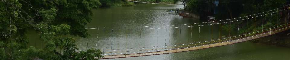
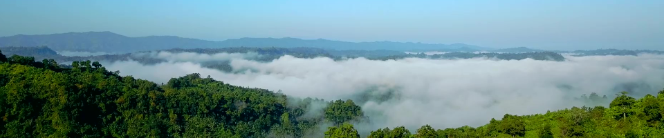
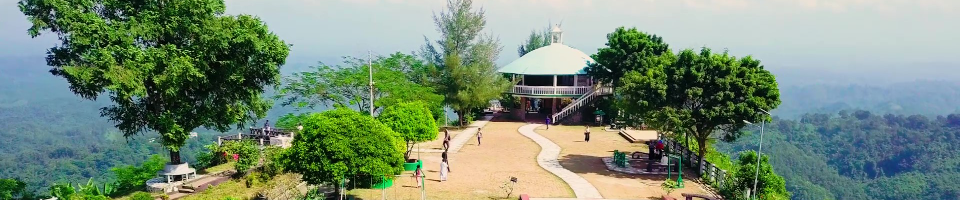
District Branding, Bandarban Hill District.

Details
Background of district administration
History of naming Bandarban district
There is a legend about the naming of Bandarban district. There are innumerable monkeys living in this area at one time. And these monkeys used to come to the mountains at the entrance of the city to eat salt. At one time, due to the incessant rains, the water level of the rhyme increased and the group of monkeys could not go to the mountain through the rhyme bank. The people of this town see this scene of the monkey crossing the rhyme. From this time on, the place became known as "Maokchi Rhyme". In Marma language, maak means monkey and chi means dam. In the course of time, the name of this area became known as Bandarban in the common pronunciation of Bengali speakers. At present, the name of this district as Bandarban has become permanent in the official documents. However, in the Marma language, the real name of Bandarban is "Rod Kyochi Mro".
Emergence as a district
The Chittagong Hill Tracts was declared a district in 180 during the British rule. At that time Bandarban was under Chittagong Hill Tracts District. Captain Magrath was the first Superintendent of the Chittagong Hill Tracts District. In 18 AD, the post of Superintendent of Chittagong Hill Tracts District was further expanded and in 18 AD, the post was renamed as Deputy Commissioner. T. H. Luin was the first Deputy Commissioner of the Chittagong Hill Tracts District. According to the Chittagong Hill Tracts Regulation of 1900, the Chittagong Hill Tracts is divided into three circles - Chakma Circle, Mong Circle, and Bomang Circle. A circle chief was appointed for each circle. Bandarban was then part of the Bomang Circle. The original name of this district is Bomang Thong due to its inclusion in the Bomang Circle.
Bandarban district started its administrative activities in 1951 as a subdivision. It was the administrative unit of Rangamati district. In the mountains, on 17 April 1971, the then Lama subdivision emerged as the Bandarban Hill District comprising seven upazilas with geographical and administrative boundaries.
District Branding Video Gallery


Planning and Implementation: Cabinet Division, A2I, BCC, DoICT and BASIS
Technical Assistance:
![]()
Developed By:
